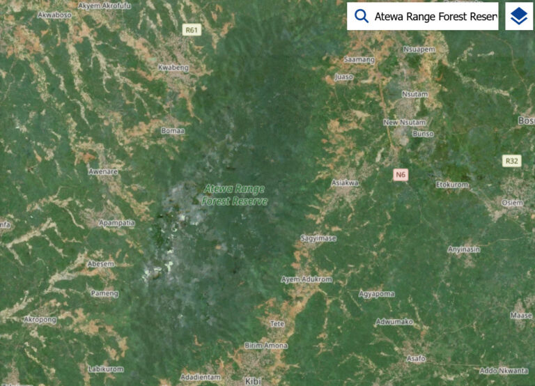
A satellite-based study of the Atewa Range Forest Reserve has identified continuing deforestation trends and increasing gaps in the forest canopy, raising concerns about the cumulative effects of human activities on the protected landscape.
The research, conducted by Ghanaian researcher Lukman Boakye Adams at Hokkaido University in Japan, used satellite imagery and geographic information systems (GIS) to examine changes in forest cover, mining activity and carbon storage in the Atewa landscape.
The doctoral thesis, submitted in September 2025, found that canopy disturbances increased over time, although 2024 recorded a decline in gap coverage that the researcher said could indicate vegetation regeneration.
The study found that the canopy disturbances were concentrated mainly near the forest’s edges and river channels, areas that may require targeted monitoring to identify and address progressive forest degradation.

The researcher used Sentinel-2 satellite imagery and a technique known as Linear Spectral Mixture Analysis to map small-scale canopy gaps.
The analysis tracked annual changes across 100-metre-by-100-metre grid cells to assess how disturbances developed over time.
The findings showed that disturbance levels could shift rapidly from low to high from one year to another.
The study also identified a non-linear relationship between forest disturbances and elevation and slope, with most recorded disturbances occurring on west-facing slopes.
These patterns suggested possible human influences, including selective logging and small-scale resource extraction.
However, the study’s findings do not establish that every detected canopy gap resulted from illegal mining or any single human activity.
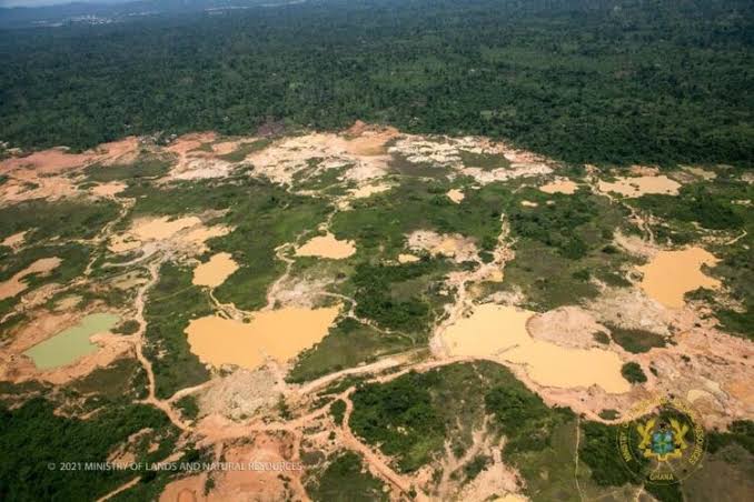
A separate analysis of high-resolution PlanetScope satellite imagery found that mining activity across the wider Atewa landscape increased at an annual rate of 12.3% between 2018 and 2023.
At least 49.7% of mining activity annually occurred within 100 metres of river channels, while 0.7% occurred within a 100-metre buffer around the forest reserve.
The study, however, recorded a decreasing trend in mining activity within the reserve itself, with a reported rate of change of -21.4%. This contrasted with the increase across the broader landscape.
The proximity of mining sites to river channels points to potential risks to aquatic ecosystems, although the reported findings do not by themselves quantify water pollution or establish specific effects on water quality.

Beyond mapping disturbances, the research estimated above-ground biomass and carbon accumulation in the reserve using satellite data and field measurements.
Its final maps recorded mean above-ground biomass of 115.12 megagrams per hectare and mean carbon accumulation of 88.79 megagrams per hectare.
The researcher said the findings demonstrated the value of combining high-resolution satellite imagery, GIS and field data to monitor changes in tropical forest reserves.
The thesis recommends stronger surveillance, enforcement of buffer-zone regulations and strategic reforestation to protect the Atewa Range Forest Reserve and surrounding ecosystems.
The study, titled Assessment of the Effects of Anthropogenic Activities on Forest Resources Using Remote Sensing and GIS: A Case Study of the Atewa Range Forest Reserve in Ghana, was submitted to Hokkaido University’s Graduate School of Environmental Science on September 25, 2025.